QGIS for Public Health
What you will learn from this training
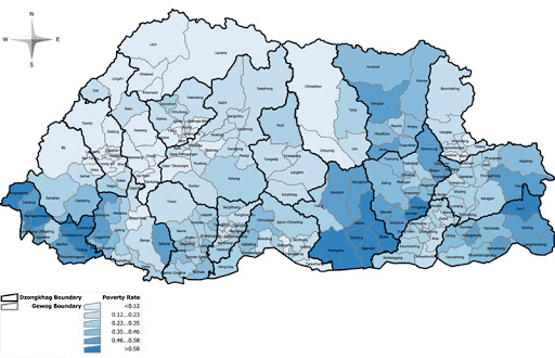
This training is expected to teach you how to implement basic concepts of GIS in public health using the most popular open source software tool (QGIS). You will learn how to use maps and geographic information systems in public health and epidemiologic work in all communities. In this module, we will teach you how to use the software to enable you better understand the geographic distribution of a disease and its geographical risk factors using the QGIS®. You will then learn GIS as a tool for displaying spatial data and conduct a detailed exploration using both epidemiological and spatial data.
General requirements
This training requires you to have basic knowledge of operating computer, use of softwares inlcuding web browsers. Knowledge in public health will be extremely useful, however, it is not a must. An interest in working with spatial data will help you learn better. The course will be demonstrated using a QGIS version of Windows PC. Mac and Linux users will have to adapt the instructions to their operating systems.
Who needs this course
This training course is aimed at training clinicians, Nurses, public health experts, laboratory personnels, veterinarians and students who wants to learn to analyse health data using spatial data analysis techniques. At the end of this training you will be confident in your ability to engage with the software and applying it to guide people working in public health make better intervention decision using spatial data.
| CRN | Item | Fee (Nu.) |
| 7001.0 | QGIS in Public Health | 25000.00 |